AI-driven geospatial assistants are revolutionizing how we use maps. By combining large language models with WebGIS, these tools improve navigation, public services, disaster response, and urban planning.
AI-Powered Geospatial Assistants for WebGIS Public Services
Technology is evolving faster than ever, and intelligent mapping tools are transforming how people interact with geographic information. One of the most notable developments in this field is AI-powered geospatial assistants, which combine artificial intelligence with advanced spatial data analysis. Recent research by Dorobantu and Badea (2026) shows that intelligent mapping assistants based on Large Language Models (LLMs) significantly improve WebGIS public service applications.
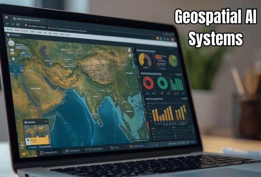
WebGIS, or Web Geographic Information Systems, enables users to access and visualize geographic data online. When artificial intelligence is integrated into these platforms, geospatial AI systems make WebGIS environments more interactive, user-friendly, and efficient. As a result, students, engineers, researchers, and public service organizations benefit from faster and more intuitive access to location-based information.
Understanding AI-Powered Geospatial Assistants
In simple terms, AI-enabled spatial assistants are intelligent mapping tools that allow users to interact with maps using natural language. Instead of manual searches, users can ask questions and receive instant, location-aware responses. These systems function as AI-based location assistants, powered by Large Language Models and spatial intelligence.
For example, a user might ask about the nearest hospital or which roads are closed due to flooding. In response, the geospatial intelligence platform processes real-time spatial data and delivers accurate, map-based insights within seconds.
Over time, governments and organizations have adopted intelligent spatial assistants to improve public communication, emergency coordination, and urban planning efficiency.
How Do They Work?
Behind the scenes, AI-driven mapping assistants combine language models with geospatial databases and live data feeds. First, the system interprets the user’s intent using natural language processing. Next, it connects that intent to relevant geographic datasets.
Additionally, machine learning algorithms analyze satellite imagery, weather reports, traffic updates, and infrastructure maps. As a result, smart geospatial systems provide reliable recommendations, even in complex scenarios such as natural disasters and infrastructure failures.
Why AI-Powered Geospatial Assistants Are Valuable
These intelligent geospatial tools simplify complex spatial data, making it accessible to non-technical users. Therefore, individuals without GIS expertise can understand geographic insights without specialized training. Moreover, such mapping assistants save time by eliminating the need to search across multiple platforms.
In emergency scenarios, AI-enhanced location assistants enable rapid access to accurate spatial data, supporting safer and faster decision-making. Similarly, engineers and planners rely on geospatial AI platforms to design efficient transportation networks and sustainable cities.
Practical Applications of AI-Powered Geospatial Assistants
Today, AI-driven spatial assistants are used across multiple industries:
- Disaster management: supporting early warnings and emergency response planning
- Urban development: enabling data-driven city design using spatial intelligence
- Tourism platforms: helping travelers locate attractions and services efficiently
- Education: enhancing interactive learning in geography, science, and engineering
As artificial intelligence advances, the applications of intelligent mapping systems continue to expand in scope, accuracy, and reliability.
Challenges and Future of AI-Powered Geospatial Assistants
Despite their benefits, smart geospatial assistants depend heavily on data quality. Outdated or incomplete datasets can reduce accuracy. Furthermore, privacy concerns remain critical because location data is highly sensitive.
However, ongoing research is improving validation methods, transparency, and ethical safeguards. Consequently, trust in AI-driven geospatial technologies continues to grow.
Why Students Should Learn About AI-Powered Geospatial Assistants
For students, AI-based spatial assistants represent a powerful intersection of artificial intelligence, geography, and engineering. Learning about these systems opens career paths in data science, urban planning, environmental analysis, and disaster management.
More importantly, intelligent geospatial tools demonstrate how emerging technologies can solve real-world problems and enhance public services.
Conclusion: The Future of AI-Powered Geospatial Assistants in WebGIS
In conclusion, AI-powered geospatial assistants are reshaping how WebGIS platforms operate. By combining natural language processing with spatial intelligence, these tools make geographic data more accessible, interactive, and actionable.
As research and development continue, next-generation AI-driven geospatial assistants will play a critical role in education, public services, and location-based decision-making.
Additionally, to stay updated with the latest developments in STEM research, visit ENTECH Online. Basically, this is our digital magazine for science, technology, engineering, and mathematics. Further, at ENTECH Online, you’ll find a wealth of information.
Reference
- Dorobantu, G. I., & Badea, A. C. (2026). LLM-Based Geospatial Assistant for WebGIS Public Service Applications. AI, 7(2), 64. https://doi.org/10.3390/ai7020064
- Author
- Latest Posts

Kottauppari Venkat Raghava
I am a technology-driven IT graduate with a strong passion for science and innovation. I am fascinated by how innovations like artificial intelligence, robotics, and emerging technologies are shaping our world. I specialize in analyzing complex scientific and technological research and presenting it in a clear, accessible way. My goal is to make science and technology understandable and engaging for students, tech enthusiasts, and professionals alike. By breaking down advanced concepts into simple, insightful narratives, I strive to inspire curiosity, learning, and innovation, helping readers stay informed about the breakthroughs that are shaping the future.


