Researchers developed AI palm tree detection using UAV deep learning to identify, map, and count palm trees automatically from aerial drone images.
AI Palm Tree Detection Using UAV Deep Learning Breakthrough
At present, researchers are testing AI palm tree detection using UAV deep learning for agricultural monitoring.It focuses on detecting, locating, and counting palm trees automatically. At first, drones capture aerial images of large plantations. These images cover wide areas quickly. As a result, researchers obtain high-resolution data for analysis.
To explain, the system applies deep learning algorithms to each image. The model scans patterns and shapes. It then identifies palm trees accurately. In contrast, manual surveys require time and large teams. However, AI systems process images quickly. As can be seen, technology simplifies agricultural monitoring. All things considered, this approach shows how artificial intelligence supports modern farming.
How AI Palm Tree Detection Using UAV Deep Learning Works
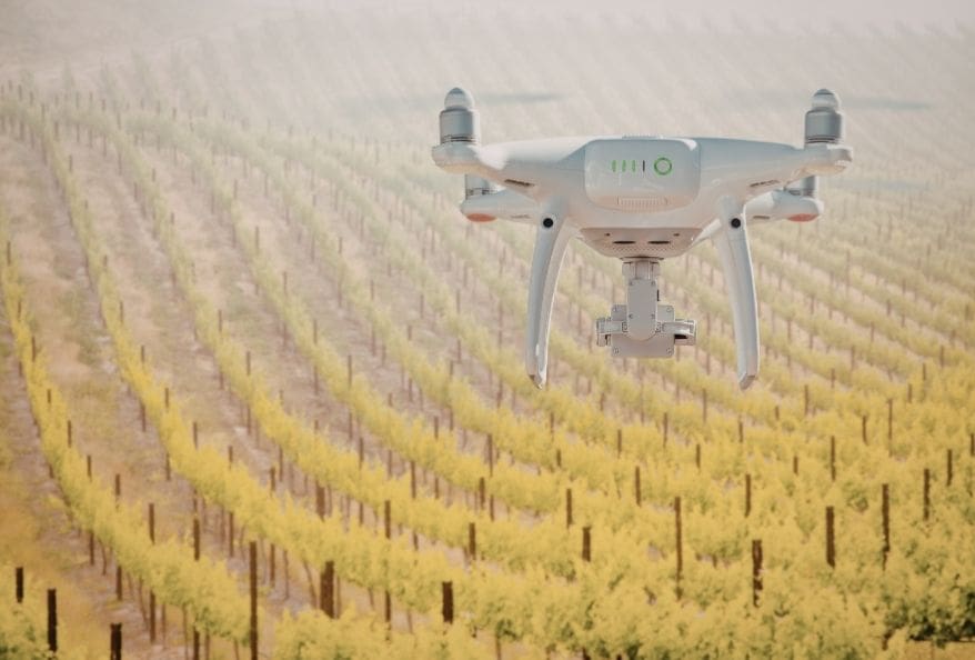
UAV Drone Images for AI Palm Tree Detection
At this point, drones collect aerial photographs across plantations. These images contain thousands of trees. Therefore, traditional counting methods become difficult. To illustrate, the research team used unmanned aerial vehicles equipped with cameras. The cameras captured detailed images from above. After that, the system processed these images using deep learning. In effect, the algorithm learned how palm trees appear from aerial views. As a result, the model could recognize tree shapes and canopy patterns. With this in mind, the system detected trees automatically. In short, drone imagery provides the raw data, while artificial intelligence performs the analysis.
Deep Learning Models for AI Palm Tree Detection and Counting
Another key point involves the AI model itself. The researchers trained neural networks using labeled aerial images. At least thousands of examples helped the model recognise palm trees correctly. In general, training improves detection accuracy. To put it differently, the algorithm studies patterns repeatedly. Eventually, it learns to distinguish palm trees from other objects. At the same time, the system calculates geographic coordinates. Therefore, each detected tree receives a mapped location. As a result, the software generates plantation maps together with tree counts.
Why AI Palm Tree Detection Using UAV Deep Learning Matters
Faster Agricultural Surveys
At the present time, agriculture relies on accurate field data. Farmers need to know the number of trees in plantations. However, manual counting requires significant effort. In contrast, AI systems perform the task quickly. To enumerate, drone surveys can cover large farms within minutes. The AI model processes data immediately after image capture. As a result, plantation managers obtain reliable numbers faster. All in all, faster surveys improve farm planning.
Better Plantation Management
Another advantage involves decision making. Accurate tree counts support better agricultural management. For example, farmers can estimate crop yield more precisely. They can also monitor missing or damaged trees. In addition, geo-location mapping helps identify problem areas. Therefore, farmers can apply fertilizer or irrigation only where needed. As a result, resources are used more efficiently. All things considered, technology improves productivity and sustainability.
Applications of AI Palm Tree Detection Using UAV Deep Learning
Smart Farming Systems
At this stage, agriculture is becoming increasingly digital. Many farms use drones, sensors, and data platforms. To explain, these technologies form part of precision agriculture. Precision agriculture relies on accurate data. AI palm tree detection supports this system by providing reliable plantation information. At the same time, farmers can integrate drone data with other digital tools. As a result, agriculture becomes more data-driven.
Large-Scale Plantation Monitoring
Large plantations often cover hundreds of hectares. Therefore, monitoring them becomes challenging. However, UAV technology simplifies the process. Drones can capture thousands of images quickly. After that, AI systems analyze those images automatically. In effect, the system produces maps showing tree locations and counts. To sum up, this method enables efficient large-scale plantation management.
Challenges and Future Development
Environmental and Technical Limitations
While this may be true, some challenges remain. Weather conditions can affect drone flights. In addition, image quality influences detection accuracy. At any rate, researchers continue improving algorithms and training datasets. As a result, future systems will become more reliable.
Future Improvements in Agricultural AI
Sooner or later, similar AI systems may detect tree diseases. They could also measure plant growth and health. To illustrate, researchers may combine aerial imaging with multispectral sensors. Such systems could monitor crop health automatically. In short, agricultural AI will expand rapidly.
Final Thoughts on AI Palm Tree Detection
In conclusion, AI palm tree detection using UAV deep learning demonstrates how artificial intelligence improves agricultural monitoring. Drone images provide large amounts of data, and deep learning algorithms analyze this data quickly. As a result, plantations can be mapped and counted automatically. All things considered, this technology supports efficient and sustainable agriculture. In the future, similar systems will likely become common in farms worldwide.
Additionally, to stay updated with the latest developments in STEM research, visit ENTECH Online.
Reference
- Mazinani, A., Norouzi, M., Talaeizadeh, A., Alasty, A., Saadat Foumani, M., & Kolahdooz, A. (2026). Innovative Real-Time Palm Tree Detection, Geo-Localization and Counting from Unmanned Aerial Vehicle (UAV) Aerial Images Using Deep Learning. Automation, 7(2), 51. https://doi.org/10.3390/automation7020051
- Author
- Latest Posts

Kottauppari Venkat Raghava
I am a technology-driven IT graduate with a strong passion for science and innovation. I am fascinated by how innovations like artificial intelligence, robotics, and emerging technologies are shaping our world. I specialize in analyzing complex scientific and technological research and presenting it in a clear, accessible way. My goal is to make science and technology understandable and engaging for students, tech enthusiasts, and professionals alike. By breaking down advanced concepts into simple, insightful narratives, I strive to inspire curiosity, learning, and innovation, helping readers stay informed about the breakthroughs that are shaping the future.

