Learn what GPS technology is, how it works, and how it powers smart transportation, taxi apps, maps, safety tools, and future STEM careers.
What Is GPS Technology? A Teen Guide to Smart Transportation
Estimated reading time: 6 minutes
Have you ever opened a map app, checked how far your destination is, or booked a ride through a taxi service and wondered how the app knows where you are? That “little blue dot” on your phone may look simple, but behind it is a powerful mix of satellites, mathematics, engineering, software, and real-time data.
GPS technology is undeniably one of the best everyday examples of STEM in action. Specifically, it connects space science with coding, physics with geography, and data with real-world decisions. Consequently for teenagers interested in Science, Technology, Engineering, and Mathematics, GPS is not just a tool for travel. Instead, it is a window into how modern cities move.
What Is GPS Technology?
GPS stands for Global Positioning System. Specifically, it is a satellite-based navigation system that helps devices find their location on Earth. A GPS-enabled phone, car navigation system, smartwatch, or tracking device receives signals from satellites and uses those signals to estimate position, speed, direction, and time.
In simple words, GPS answers three important questions:
- Where am I?
- How fast am I moving?
- How can I reach my destination?
This technology is used in maps, delivery apps, emergency services, public transport systems, school buses, taxi apps, fitness trackers, agriculture, aviation, shipping, and also outdoor adventure activities.
“GPS is a great example of invisible technology: most people use it every day, but only curious minds stop to ask how it works.”
How Does GPS Work?
GPS may feel like magic, but it is based on science and mathematics. Satellites orbit the Earth and send signals that include their position and the exact time the signal was sent. Next, your device receives signals from multiple satellites and calculates how far away each satellite is.
To estimate your location, the device compares these distances. This process is called trilateration. The more accurate the signals and calculations are, the more accurate your location becomes.
However, a phone does not rely on GPS alone. Rather, modern devices often combine several technologies:
- GPS satellite signals
- Mobile network data
- Wi-Fi positioning
- Motion sensors
- Digital maps
- Traffic information
- App-based algorithms
That is why your map app can usually find your position faster in a city than in an isolated area with weak signal.
GPS Technology Used in Daily Transportation
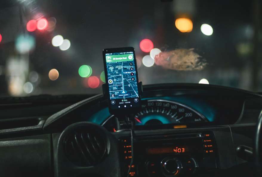
Transportation is certainly one of the most visible uses of GPS technology. Whether you are going to school, visiting a science museum, meeting friends, or travelling with family, GPS quietly supports the journey.
Here is how GPS helps different transport systems:
| Area of Use | How GPS Helps | Why It Matters |
|---|---|---|
| Taxi and ride apps | Finds pickup and drop-off points | Saves time and reduces confusion |
| School buses | Tracks routes and arrival times | Helps parents and schools monitor safety |
| Public transport | Shows bus or train movement | Makes commuting easier |
| Delivery services | Guides drivers to addresses | Improves speed and accuracy |
| Emergency vehicles | Finds the fastest route | Can help save lives |
| Personal navigation | Suggests routes and travel time | Helps people move confidently |
For students, this table shows something important: one technology can solve many different problems when it is combined with good design and data.
Why GPS Is Important for Teenagers to Understand
Teenagers today are growing up in a world where location-based technology is everywhere. Understanding GPS helps students become smarter users of technology and may also inspire future career choices.
For example, a teenager interested in coding may explore how route-planning apps work. Similarly, someone who enjoys geography may study digital mapping. Meanwhile, a student who likes physics may become curious about satellites and signals. A design-focused student may also think about how to make transport apps easier for older people, tourists, or people with disabilities.
GPS connects many STEM fields:
- Physics: satellite signals, time, speed, and distance
- Mathematics: coordinates, geometry, and calculations
- Computer science: algorithms, apps, and databases
- Engineering: satellites, sensors, vehicles, and networks
- Geography: maps, routes, cities, and terrain
- Data science: traffic patterns and travel predictions
This is why GPS is more than a navigation tool. It is a real-world learning topic.
How Smart Transportation Uses GPS and Data
Smart transportation means using technology to not only make travel safer, faster, cleaner, but also more efficient. GPS is one part of this system, but it works best when combined with other data.
For instance, Imagine a taxi app. It does not only need to know where the passenger is. It also needs to know where nearby drivers are, how long the trip may take, whether there is traffic, which route is better, and how much the ride may cost.
That requires:
- Location tracking
- Map data
- Route calculation
- Traffic updates
- User interface design
- Payment technology
- Safety features
- Customer support systems
Each of these parts can become a STEM project or career path.
A Simple STEM Activity: Study Your Daily Route
Students can learn a lot by observing a route they already know, such as the route from home to school, a library, or a sports class.
Try this simple activity:
- Choose a familiar route.
- Estimate the travel time before checking a map app.
- Open a navigation app and compare your estimate.
- Notice if the app suggests more than one route.
- Think about why one route may be faster.
- Observe traffic, signals, road width, turns, and distance.
- Write down what data the app might be using.
This activity can become a mini project for a science or technology class. For example, students can create charts, compare travel times, or even design an improved route-planning idea for their neighbourhood.
Career Ideas Connected to GPS Technology
GPS technology can lead to many exciting careers. Teenagers who enjoy problem-solving can explore fields such as:
- App development
- Robotics
- Satellite engineering
- Urban planning
- Data science
- Transport engineering
- Cybersecurity
- Geographic Information Systems
- Artificial intelligence
- Automotive technology
Future transport may include self-driving vehicles, smarter traffic lights, cleaner public transport, drone deliveries, and better emergency response systems. All of these areas will need young people who understand technology and care about solving real problems.
Responsible Use of Location Technology
GPS is useful, but it also raises questions about privacy and safety. Location data can reveal where a person lives, studies, works, or travels. That is why students should learn to use GPS-based apps responsibly.
A few smart habits include:
- Share live location only with trusted people.
- Check app permissions before allowing location access.
- Turn off location access for apps that do not need it.
- Avoid posting real-time location publicly.
- Use trusted services when travelling.
- Talk to parents or guardians about safety settings.
Technology is most powerful when it is used wisely.
Final Thoughts
GPS technology is a perfect example of how STEM appears in everyday life. It helps us navigate cities, book rides, track deliveries, improve public transport, and also plan safer journeys. For teenagers, learning about GPS is not only useful for school projects. It can also open the door to future careers in engineering, coding, data science, transport, and space technology.
The next time you see a moving dot on a map, remember that it represents not just satellites, mathematics, software, design, but also human creativity working together. That is the beauty of STEM: it turns invisible ideas into tools that help people move through the world.
Additionally, to stay updated with the latest developments in STEM research, visit ENTECH Online. Basically, this is our digital magazine for science, technology, engineering, and mathematics. Further, at ENTECH Online, you’ll find a wealth of information.
- Author
- Latest Posts

Kottauppari Venkat Raghava
I am an Information Technology graduate (B.Tech) and a technology writer specialising in artificial intelligence, robotics, automation, and space technologies. I analyse complex scientific research and convert it into clear, practical insights for students, tech enthusiasts, and professionals. My work bridges the gap between academic research and real-world understanding by simplifying findings from peer-reviewed journals into engaging, easy-to-follow content. Alongside my writing, I have hands-on experience developing real-world projects, showcased on my GitHub, including an Expense Tracker web application for managing and visualising spending, and a Simple Video Summariser that generates concise insights from video content using automation techniques. I also produce research-driven articles on topics such as AI-powered corrosion detection, deep learning in engineering, and advanced automation systems. I follow a research-driven approach, ensuring every article is grounded in verified sources, industry knowledge, and practical applications. My goal is to make advanced technology accessible and meaningful, helping readers stay informed about innovations shaping the future.