The approach improves inference of individual movement patterns where direct tracking is limited, enhancing ecological and conservation applications
Bayesian Classification Model Tracks Riverine Fish Lifetime Movement Patterns
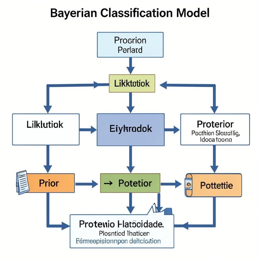
Researcher Kaitlyn O’Mara and their team developed a clever method using otoliths found in fish ears. At the core of this approach, these crystals store chemical signatures from the surrounding water. Over time, analyzing these signatures allows scientists to map fish movements without tagging them. In a similar way, the Bayesian Classification Model combines advanced math and biology. With this method, scientists can reveal fish travel routes in rivers. All in all, this work shows how technology and nature come together for real-world discoveries.
TL;DR ‘Bayesian Classification Model’
A Bayesian model uses clues from the environment to rebuild the life movements of river fish over different sizes. It connects biology, chemistry, and health to spark interest in STEM jobs.
Key Takeaways
- Otolith Chemistry: Fish ear stones accumulate elements reflecting water chemistry as they grow.
- Isoscapes: Maps of river chemistry guide researchers in linking fish crystal data to locations.
- Bayesian Models: Advanced statistical tools help predict likely fish pathways over time.
- Mussels as Helpers: Mussel shells capture changing water chemistry, improving map accuracy.
- Error Management: New methods reduce errors early in fish movement predictions for better clarity.
This research shows that by examining small natural clues and using clever computer simulations, we can learn a ton about how animals live their lives. It demonstrates how fields in STEM—such as biology, chemistry, math, and statistics—team up to crack fascinating mysteries about our environment.
The Science Behind Tracking Fish: Step by Step
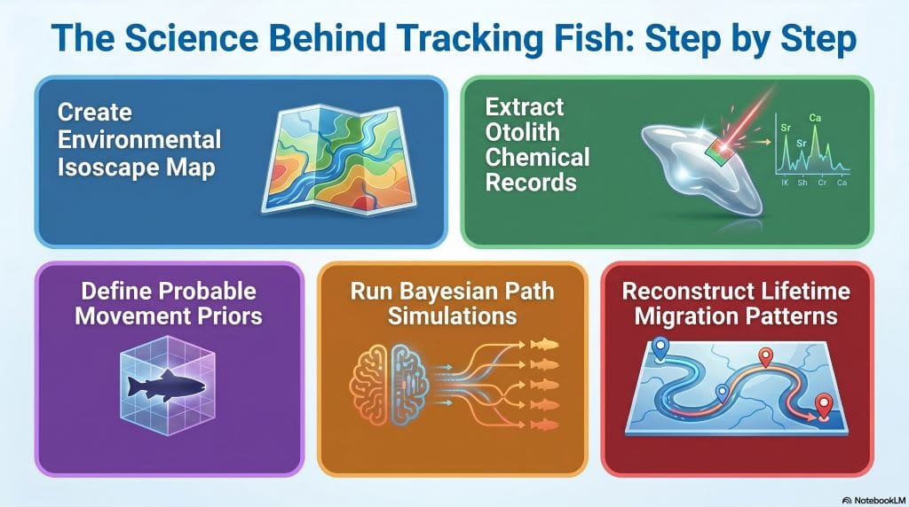
The process follows clear steps using advanced tools to study an entire river system. At the first stage, scientists create an isoscape map. Along the river course, they sample water and mussels to capture isotope changes by place and season. In the next phase, they examine otoliths using laser tools. At this point, isotope ratios in growth layers reveal where fish lived at different life stages. In the following step, they apply a Bayesian model. With this approach, isotope data is linked to likely movement paths, while also including geography and species movement limits.
This combined method rebuilds movement paths. In addition, it improves understanding of natural processes. Most importantly, it identifies travel barriers and preferred habitats. Furthermore, this occurs because known landforms are directly included in the study.
Mussels: The Unsung Heroes
Mussels are sedentary creatures, meaning they remain in one place. To begin with, their shells record daily chemical information similar to fish otoliths. Consequently, they provide continuous records of local water chemistry changes.
This helps scientists tackle problems caused by fluctuating isotope levels. For this reason, tracking becomes more reliable than using occasional water samples alone. On the whole, shell data allow researchers to build more detailed and dynamic isoscapes without heavy fieldwork.
The Mitchell River Study
Scientists conducted mathematical testing in rural Australia, focusing on the vast and complex Mitchell River. At the outset, the river showed a mix of deep waterholes and shallow riffles, creating a diverse habitat. Along the way, researchers collected fish from two distinct sites for balance. To list clearly, they identified and tested four unique fish species. In the meantime, numerous samples were gathered from a shallow floodplain wetland area. At the same moment, the team examined conditions in the flowing main river channel. In the end, they mapped the entire study area, highlighting its rich ecological diversity.
Virtual Fish Models
| Stage | Description |
|---|---|
| Initial Setup | Scientists first built a simulated river map for testing. At the initial stage, this setup allowed controlled analysis of the system.. |
| Model Design | They created three distinct virtual fish movement groups. |
| Short Movement | Some fish were modeled to move short distances each day. |
| Long Movement | Other fish were designed to travel very long distances daily. |
| Performance Insight | As can be seen, the complex mathematical model performed extremely well. |
| Accuracy | The model successfully predicted the exact locations of the fish. |
| Success Rate | It achieved accuracy rates of up to 95% during testing. |
| Error Analysis | For the most part, tracking errors remained extremely small across all areas. |
The Role of Technology & Statistics Explained Simply
The Bayesian model combines prior knowledge about how far fish can move between points with observed isotope data from otoliths.
- Takes previous location possibilities into account to increase accuracy;
- Puts limits on improbable movements based on physical river barriers or typical swimming ranges;
- Adds layers of probability rather than forcing hard yes/no conclusions — encouraging careful interpretation;
- Makes adjustment for possible mistakes early in life stage classification via Monte Carlo simulations (randomized trials).
This flexibility provides more reliable movement patterns than older techniques. In comparison with earlier methods, it accounts for natural behaviors and geography. For that reason, ecological understanding is brought closer into calculations that were once dominated purely by numbers.
Frequently asked Questions
Q1: Why use otoliths instead of traditional tagging?
A1: Otolith analysis doesn’t require catching or tagging live fish multiple times.
Q2: What skills are necessary for such research?
A2: Strong backgrounds in biology, chemistry, statistics/statistical programming help most
Q3. What is an otolith?
A3: it stores a chemical record. Scientists read this hidden bony structure very carefully in labs. To sum up, it reveals the whole life story clearly. In sum, it is super useful for aquatic biology experts.
Q4: What is an isoscape?
A4: it helps track precise animal paths for ecology. In essence, it works just like nature’s GPS for fish. Then again, rivers change over incredibly long periods of time. In general, testing mussel shells makes the map extremely accurate
Additionally, to stay updated with the latest developments in STEM research, visit ENTECH Online.
Reference:
- Venarsky, M. P., Boone, E. L., Stewart‐Koster, B., Crook, D. A., O’Mara, K., Woodhead, J., Maas, R., & Bunn, S. (2026). A Bayesian classification model to reconstruct lifetime movement patterns of riverine fish using environmental tracers. Methods in Ecology and Evolution, 00, 1–16. https://doi.org/10.1111/2041-210x.70297
- Author
- Latest Posts
I completed my Master of Science from the University of Allahabad in 2017 with a strong academic background in life sciences and chemistry. My specialization included Molecular Biology, Microbiology, Genetics, Plant Breeding, Phycology, Paleobotany, and Bioinformatics, along with Organic Chemistry, Inorganic Chemistry, and Physical Chemistry. This multidisciplinary training provided me with a comprehensive understanding of biological systems and analytical scientific approaches.
After completing my postgraduate studies, I gained valuable professional experience in both the education and social development sectors. I worked at A.M. Oxford Public School, where I was actively involved in guiding students toward academic excellence. In this role, I focused on creating an engaging learning environment, encouraging critical thinking, and nurturing students’ curiosity for scientific learning. My experience as an educator strengthened my communication, mentoring, and classroom management skills.
In addition to my teaching experience, I worked with Jeevan Jagriti Foundation, where I contributed to community-based initiatives aimed at improving educational access and awareness among underprivileged sections of society. Through this work, I participated in programs designed to support social development and promote the value of education in marginalized communities.
These professional experiences helped me develop strong interpersonal, leadership, and organizational skills while reinforcing my commitment to education and community service.